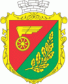
Znamianka (Znamyanka)
 |
 |
It is located about half way between the regional center Kropyvnytskyi (west), and cities of Oleksandriia (east) and Svitlovodsk (north).
Znamianka was established in 1869 when there started train movement between Kharkiv and Odessa in area that historically was known as Black Forest (or Nigra Sylva). At the meadow of Black Forest, through which stretched a segment of Yelizavetgrad – Kriukov (west–east), there was built the train station main building and its offices. The station was named after the original village Znamianka that was located 3 km away and today is known as Znamianka Druha.
To the area were resettled peasants from the Oryol Governorate area, possible the Russian Old Believers for whom the Our Lady of the Sign sacred. In Russian the Sign means Znamiennie, so in diminutive form the settlement's name became Znamianka.
In 1873 there was opened movement of trains on the segment Znamianka – Mykolaiv, in 1876 towards Fastiv. Out of a small train station Znamianka started to transform into a rail hub. Znamianka became a train station at four-way crossroads northeast towards Kremenchuk, south towards Mykolaiv, west towards Balta and northwest towards Fastiv.
Simultaneously with building of the train station on a land lot that was rent out from landowners Osipovs by people from neighboring villages and other counties (uyezds), there appeared a small settlement of railway workers, Osipovoye. In 1886 there already were 24 private houses, an earth shelter, six trading places and population of 143. Couple of dozens years later just south of the train station there appeared another settlement of Linitskoye. In 1913 in both Osipovoye and Linitskoye lived about 6,000 people.
In the beginning for sometime the train station was classified of the third category with its locomotive depot accounting for 4 locomotives. In December 1883 when there ended construction of the new train station building, there were 29 locomotives and the depot employed some 92 workers. In the 1890s the rail hub was shipping out some 580,000 poods of bread annually.
During the 1917 to 1921 Ukrainian War of Independence Znamianka was part of the Kholodny Yar Republic.
During World War II Znamianka was under German occupation from August 5, 1941 to December 9, 1943.
In January 1989 the population was 33 828 people.
Map - Znamianka (Znamyanka)
Map


Country - Ukraine
 |
 |
| Flag of Ukraine | |
During the Middle Ages, Ukraine was the site of early Slavic expansion and the area later became a key centre of East Slavic culture under the state of Kievan Rus', which emerged in the 9th century. The state eventually disintegrated into rival regional powers and was ultimately destroyed by the Mongol invasions of the 13th century. The area was then contested, divided, and ruled by a variety of external powers for the next 600 years, including the Polish–Lithuanian Commonwealth, the Austrian Empire, the Ottoman Empire, and the Tsardom of Russia. The Cossack Hetmanate emerged in central Ukraine in the 17th century, but was partitioned between Russia and Poland, and ultimately absorbed by the Russian Empire. Ukrainian nationalism developed, and following the Russian Revolution in 1917, the short-lived Ukrainian People's Republic was formed. The Bolsheviks consolidated control over much of the former empire and established the Ukrainian Soviet Socialist Republic, which became a constituent republic of the Soviet Union when it was formed in 1922. In the early 1930s, millions of Ukrainians died in the Holodomor, a man-made famine. During World War II, Ukraine was devastated by the German occupation.
Currency / Language
| ISO | Currency | Symbol | Significant figures |
|---|---|---|---|
| UAH | Ukrainian hryvnia | â‚´ | 2 |
| ISO | Language |
|---|---|
| HU | Hungarian language |
| PL | Polish language |
| RU | Russian language |
| UK | Ukrainian language |